| Site Administrator Help |

|
|||
|
|
|||
|
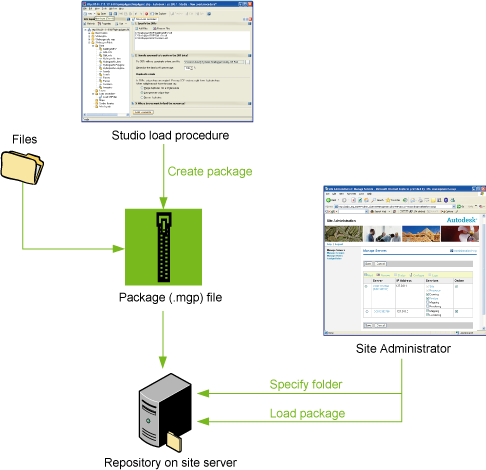
About Packages During the process of loading file-based data in Autodesk MapGuide Studio, you can create data packages (.mgp files). Large source data files can be zipped up in this file format and saved to a network location. All package files must be saved in a single folder. You specify the location of the package folder with the Site Administrator program (on the Configure Services page: Packages folder). You then use the Load Packages page to extract the data directly into the resource repository on the site server. The advantages of creating spatial data packages are as follows:
The process of creating and loading a package file looks like this:
You specify the location of the package folder using the Site Adminstrator program, then create the package from a load procedure in Autodesk Studio, and finally load the package using Site Adminstrator.
|
|