Advanced WMS Configuration
For advanced WMS configuration, you can also edit the OgcWmsService.config.awd file (located in MapGuide_server_installation_directory\Wms).
1
You can delete the default reference system (supported by alllayers):
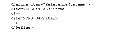
This can be used to stop WMS from applying coordinate transformations to layers such as raster images that use a different coordinate system.
2 You can add more mappings to the EPSG to WKT mapping section:
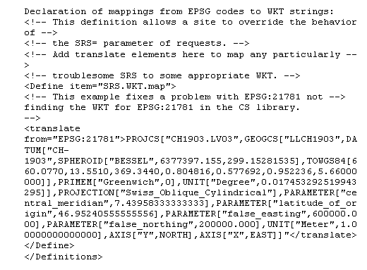
|